
Erongo Region topographic map
Interactive map
Click on the map to display elevation.
About this map
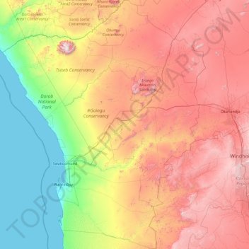
Name: Erongo Region topographic map, elevation, terrain.
Location: Erongo Region, Namibia (-23.80888 13.63272 -20.49159 16.55596)
Average elevation: 867 m
Minimum elevation: 0 m
Maximum elevation: 2,454 m
Other topographic maps
Click on a map to view its topography, its elevation and its terrain.