
Pļaviņas topographic map
Interactive map
Click on the map to display elevation.
About this map
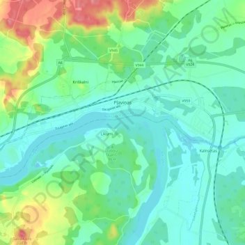
Name: Pļaviņas topographic map, elevation, terrain.
Location: Pļaviņas, Aizkraukles novads, Zemgale, Latvia (56.59909 25.66625 56.62867 25.78423)
Average elevation: 92 m
Minimum elevation: 69 m
Maximum elevation: 156 m