
Volta River topographic map
Interactive map
Click on the map to display elevation.
About this map
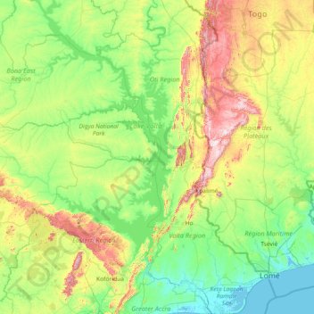
Name: Volta River topographic map, elevation, terrain.
Location: Volta River, Volta Region, Ghana (5.77421 -0.98243 8.65368 0.67282)
Average elevation: 174 m
Minimum elevation: -3 m
Maximum elevation: 941 m
Other topographic maps
Click on a map to view its topography, its elevation and its terrain.
New Bakpa
Ghana > Volta Region > Central Tongu District > New Bakpa
New Bakpa, Central Tongu District, Volta Region, Ghana
Average elevation: 9 m