
Nogales topographic map
Interactive map
Click on the map to display elevation.
Nogales
The city is at an elevation of 3,829 feet (1,167 m).
About this map
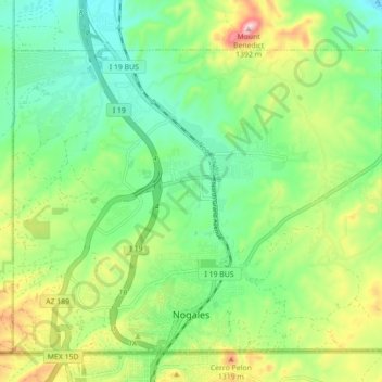
Name: Nogales topographic map, elevation, terrain.
Location: Nogales, Santa Cruz County, Arizona, 85621, United States (31.33264 -110.97695 31.39213 -110.89202)
Average elevation: 1,192 m
Minimum elevation: 1,107 m
Maximum elevation: 1,388 m
Other topographic maps
Click on a map to view its topography, its elevation and its terrain.