
Cape May County topographic map
Interactive map
Click on the map to display elevation.
About this map
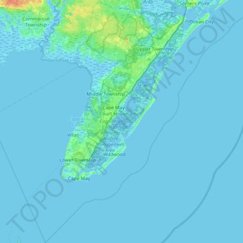
Name: Cape May County topographic map, elevation, terrain.
Location: Cape May County, New Jersey, USA (38.79113 -75.17705 39.32465 -74.49294)
Average elevation: 1 m
Minimum elevation: -5 m
Maximum elevation: 29 m
Other topographic maps
Click on a map to view its topography, its elevation and its terrain.