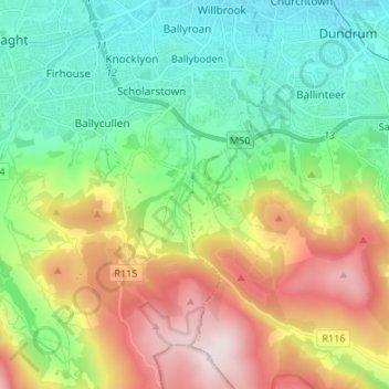
Tibradden ED topographic map
Interactive map
Click on the map to display elevation.
About this map
Name: Tibradden ED topographic map, elevation, terrain.
Average elevation: 236 m
Minimum elevation: 45 m
Maximum elevation: 584 m

Click on the map to display elevation.
Name: Tibradden ED topographic map, elevation, terrain.
Average elevation: 236 m
Minimum elevation: 45 m
Maximum elevation: 584 m