
Chatsworth CP topographic map
Interactive map
Click on the map to display elevation.
About this map
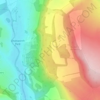
Name: Chatsworth CP topographic map, elevation, terrain.
Average elevation: 211 m
Minimum elevation: 101 m
Maximum elevation: 341 m
Other topographic maps
Click on a map to view its topography, its elevation and its terrain.
Peak District National Park
United Kingdom > England > Derbyshire Dales
Peak District National Park, A623, Tideswell CP, Derbyshire Dales, Derbyshire, East Midlands, England, SK17 8RN, United Kingdom
Average elevation: 225 m