
东方国际社区 topographic map
Interactive map
Click on the map to display elevation.
About this map
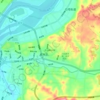
Name: 东方国际社区 topographic map, elevation, terrain.
Location: 东方国际社区, 高坪区 / Gaoping, 南充市 / Nanchong, Sichuan, 637000, Cina (30.76561 106.09769 30.80561 106.13769)
Average elevation: 298 m
Minimum elevation: 258 m
Maximum elevation: 371 m