
Taos County topographic map
Interactive map
Click on the map to display elevation.
About this map
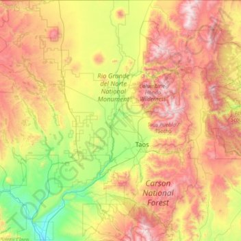
Name: Taos County topographic map, elevation, terrain.
Location: Taos County, New Mexico, USA (36.01287 -106.05840 36.99597 -105.20011)
Average elevation: 2,561 m
Minimum elevation: 1,709 m
Maximum elevation: 3,980 m