
Stadtbezirk 22 Aubing-Lochhausen-Langwied topographic map
Interactive map
Click on the map to display elevation.
About this map
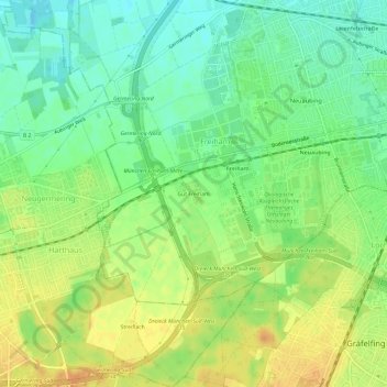
Name: Stadtbezirk 22 Aubing-Lochhausen-Langwied topographic map, elevation, terrain.
Average elevation: 537 m
Minimum elevation: 520 m
Maximum elevation: 554 m
Other topographic maps
Click on a map to view its topography, its elevation and its terrain.
Bezirksteil Altaubing
Deutschland > Bayern > München > Freiham
Bezirksteil Altaubing, Stadtbezirk 22 Aubing-Lochhausen-Langwied, Freiham, München, Oberbayern, Bayern, Deutschland
Average elevation: 521 m