
Troyes topographic map
Interactive map
Click on the map to display elevation.
About this map
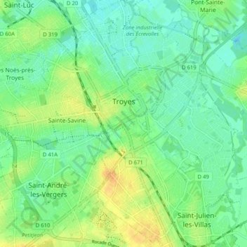
Name: Troyes topographic map, elevation, terrain.
Location: Troyes, Aube, Grand Est, Metropolitan France, 10000, France (48.26632 4.04117 48.31859 4.11114)
Average elevation: 112 m
Minimum elevation: 100 m
Maximum elevation: 132 m