
PJ topographic map
Interactive map
Click on the map to display elevation.
About this map
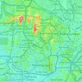
Name: PJ topographic map, elevation, terrain.
Location: PJ, Selangor, Malaysia (3.06995 101.55045 3.20858 101.66381)
Average elevation: 56 m
Minimum elevation: -4 m
Maximum elevation: 324 m
Other topographic maps
Click on a map to view its topography, its elevation and its terrain.