
Oststadt topographic map
Interactive map
Click on the map to display elevation.
About this map
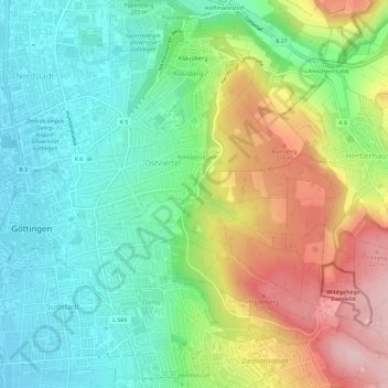
Name: Oststadt topographic map, elevation, terrain.
Location: Oststadt, Göttingen, Landkreis Göttingen, Lower Saxony, Germany (51.51875 9.94029 51.55324 9.99862)
Average elevation: 225 m
Minimum elevation: 148 m
Maximum elevation: 357 m