
Zuata topographic map
Interactive map
Click on the map to display elevation.
About this map
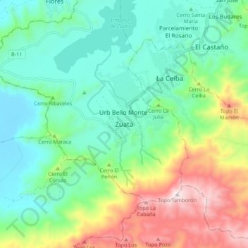
Name: Zuata topographic map, elevation, terrain.
Location: Zuata, Aragua, Venezuela (10.12366 -67.43268 10.20366 -67.35268)
Average elevation: 692 m
Minimum elevation: 446 m
Maximum elevation: 1,252 m