
Grand River topographic map
Interactive map
Click on the map to display elevation.
About this map
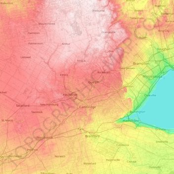
Name: Grand River topographic map, elevation, terrain.
Average elevation: 300 m
Minimum elevation: 70 m
Maximum elevation: 526 m
Other topographic maps
Click on a map to view its topography, its elevation and its terrain.
McMurrich
Canada > Ontario > Parry Sound District > McMurrich/Monteith Township
Average elevation: 337 m
Barrier Islands
Canada > Ontario > Kenora District > Unorganized Kenora District
Average elevation: 345 m