
sai topographic map
Interactive map
Click on the map to display elevation.
About this map
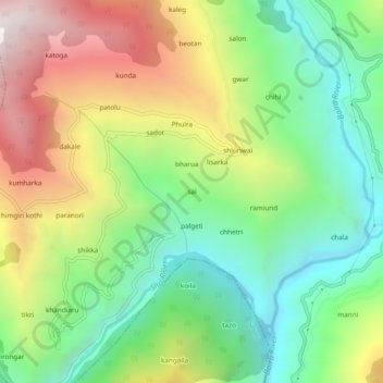
Name: sai topographic map, elevation, terrain.
Location: sai, Chaurah, Chamba, Himachal Pradesh, India (32.76300 76.11037 32.80300 76.15037)
Average elevation: 1,553 m
Minimum elevation: 949 m
Maximum elevation: 2,467 m