Geolocate

Bilohiria topographic map

Interactive map

Click on the map to display elevation.

About this map

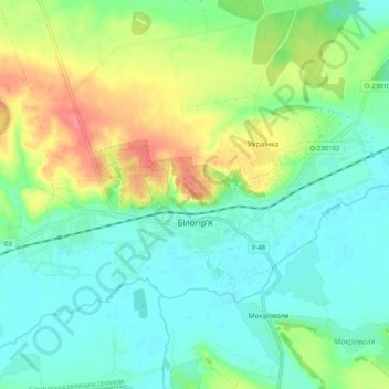
Name: Bilohiria topographic map, elevation, terrain.

Location: Bilohiria, Bilohiria Settlement Hromada, Shepetivka Raion, Khmelnytskyi Oblast, Ukraine (49.99191 26.36243 50.02125 26.46364)

Average elevation: 259 m

Minimum elevation: 235 m

Maximum elevation: 309 m

Other topographic maps

Click on a map to view its topography, its elevation and its terrain.

Orikhivka

Ukraine > Khmelnytskyi Oblast

Average elevation: 298 m

Kolodiivka

Ukraine > Khmelnytskyi Oblast

It is located in the southernmost portion of the oblast on the Dnister River at an elevation of 273 m (896 ft). The village maintains its own local government as the Kolodiivka Rural Council (Ukrainian: Колодіївська сільська рада), which consists of 21 locally elected deputies.

Average elevation: 252 m

Sokil

Ukraine > Khmelnytskyi Oblast

Average elevation: 160 m

Popivtsi

Ukraine > Khmelnytskyi Oblast

Average elevation: 316 m

Zelena

Ukraine > Khmelnytskyi Oblast

Average elevation: 308 m

Abrykosivka

Ukraine > Khmelnytskyi Oblast

Average elevation: 307 m

Demiankivtsi

Ukraine > Khmelnytskyi Oblast

Average elevation: 291 m

Kopachivka

Ukraine > Khmelnytskyi Oblast

Average elevation: 304 m

Yampil

Ukraine > Khmelnytskyi Oblast > Yampil

Average elevation: 264 m

Subich

Ukraine > Khmelnytskyi Oblast

Average elevation: 232 m