
Jamtara topographic map
Interactive map
Click on the map to display elevation.
About this map
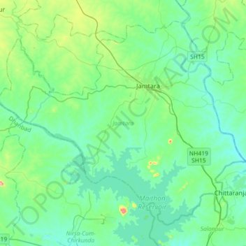
Name: Jamtara topographic map, elevation, terrain.
Location: Jamtara, Jharkhand, 815351, India (23.81409 86.62889 24.03177 86.91561)
Average elevation: 172 m
Minimum elevation: 122 m
Maximum elevation: 403 m
Other topographic maps
Click on a map to view its topography, its elevation and its terrain.