
Colle le Cese topographic map
Interactive map
Click on the map to display elevation.
About this map
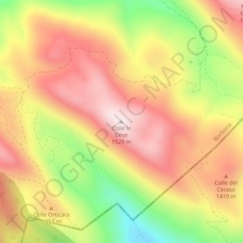
Name: Colle le Cese topographic map, elevation, terrain.
Location: Colle le Cese, Borbona, Rieti, Lazio, Italia (42.47357 13.15214 42.47367 13.15224)
Average elevation: 1,313 m
Minimum elevation: 1,027 m
Maximum elevation: 1,524 m