
汤阴县 topographic map
Interactive map
Click on the map to display elevation.
About this map
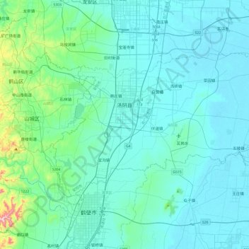
Name: 汤阴县 topographic map, elevation, terrain.
Location: 汤阴县, 安阳市, 河南省, 中国 (35.76051 114.22238 36.00998 114.69988)
Average elevation: 108 m
Minimum elevation: 55 m
Maximum elevation: 568 m
Other topographic maps
Click on a map to view its topography, its elevation and its terrain.