
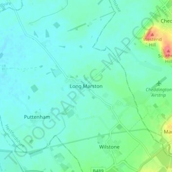
Long Marston topographic map
Interactive map
Click on the map to display elevation.
About this map
Name: Long Marston topographic map, elevation, terrain.
Average elevation: 92 m
Minimum elevation: 80 m
Maximum elevation: 140 m
Other topographic maps
Click on a map to view its topography, its elevation and its terrain.
Astrope
United Kingdom > England > Hertfordshire > Dacorum > Long Marston
Astrope, Tring Rural, Long Marston, Dacorum, Hertfordshire, England, HP23 4PJ, United Kingdom
Average elevation: 91 m