
Rudgranag topographic map
Interactive map
Click on the map to display elevation.
About this map
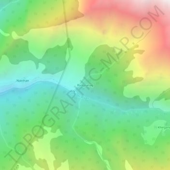
Name: Rudgranag topographic map, elevation, terrain.
Location: Rudgranag, Kullu, Himachal Pradesh, India (31.98341 77.46799 32.02341 77.50799)
Average elevation: 3,070 m
Minimum elevation: 2,220 m
Maximum elevation: 4,501 m