
Chontaduro topographic map
Interactive map
Click on the map to display elevation.
About this map
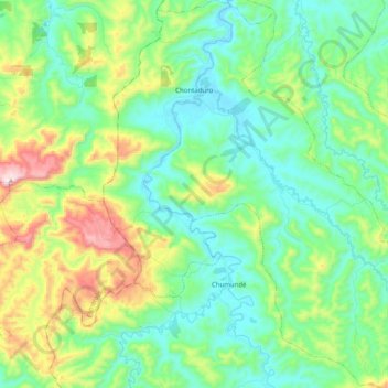
Name: Chontaduro topographic map, elevation, terrain.
Location: Chontaduro, Río Verde, Esmeraldas, Ecuador (0.77835 -79.48349 0.97841 -79.29472)
Average elevation: 168 m
Minimum elevation: 3 m
Maximum elevation: 616 m