
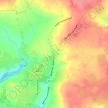
White’s Cross topographic map
Interactive map
Click on the map to display elevation.
About this map
Name: White’s Cross topographic map, elevation, terrain.
Average elevation: 103 m
Minimum elevation: 53 m
Maximum elevation: 140 m
Other topographic maps
Click on a map to view its topography, its elevation and its terrain.
Whitechurch
Ireland > Cobh Municipal District
Whitechurch, Cobh Municipal District, County Cork, Munster, T23 WF25, Ireland
Average elevation: 110 m
Glenville
Ireland > Cobh Municipal District
Glenville, Cobh Municipal District, County Cork, Munster, Ireland
Average elevation: 227 m