
Los Alamos topographic map
Interactive map
Click on the map to display elevation.
About this map
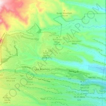
Name: Los Alamos topographic map, elevation, terrain.
Average elevation: 2,196 m
Minimum elevation: 1,990 m
Maximum elevation: 2,638 m
Los Alamos is located in northern New Mexico between the Rio Grande and the eastern rim of the Valles Caldera on the Pajarito Plateau, approximately 35 mi (56 km) to the northwest of Santa Fe. The elevation at the post office is 7,320 feet (2,230 m) and total land area is 11.14 square miles (28.9 km2).