
Juchitlán topographic map
Interactive map
Click on the map to display elevation.
About this map
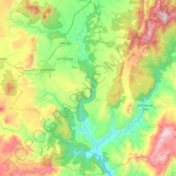
Name: Juchitlán topographic map, elevation, terrain.
Location: Juchitlán, Jalisco, Mexico (19.96319 -104.14217 20.16264 -103.94397)
Average elevation: 1,350 m
Minimum elevation: 887 m
Maximum elevation: 2,055 m