
La Huerta topographic map
Interactive map
Click on the map to display elevation.
About this map
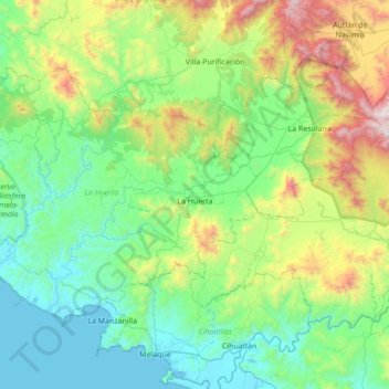
Name: La Huerta topographic map, elevation, terrain.
Location: La Huerta, Jalisco, Mexico (19.22142 -105.22030 19.76371 -104.52783)
Average elevation: 463 m
Minimum elevation: -1 m
Maximum elevation: 2,060 m