
Mandaluniz topographic map
Interactive map
Click on the map to display elevation.
About this map
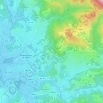
Name: Mandaluniz topographic map, elevation, terrain.
Location: Mandaluniz, Frúniz, Vizcaya, País Vasco, 48120, España (43.32197 -2.81014 43.36197 -2.77014)
Average elevation: 116 m
Minimum elevation: 26 m
Maximum elevation: 479 m