
Ventron topographic map
Interactive map
Click on the map to display elevation.
About this map
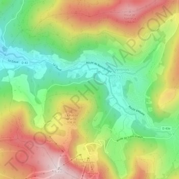
Name: Ventron topographic map, elevation, terrain.
Average elevation: 809 m
Minimum elevation: 565 m
Maximum elevation: 1,105 m
Other topographic maps
Click on a map to view its topography, its elevation and its terrain.
Haut du Rouge Gazon
France > Grand Est > Vosges > Ventron
Haut du Rouge Gazon, Ventron, Saint-Dié-des-Vosges, Vosges, Grand Est, France métropolitaine, 88310, France
Average elevation: 928 m