
DeWitt County topographic map
Interactive map
Click on the map to display elevation.
About this map
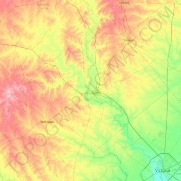
Name: DeWitt County topographic map, elevation, terrain.
Location: DeWitt County, Texas, United States (28.81328 -97.75486 29.38454 -96.97677)
Average elevation: 80 m
Minimum elevation: 11 m
Maximum elevation: 179 m
Other topographic maps
Click on a map to view its topography, its elevation and its terrain.