
Tonasket topographic map
Interactive map
Click on the map to display elevation.
Tonasket
Tonasket is located at 48°42′20″N 119°26′19″W / 48.70556°N 119.43861°W / 48.70556; -119.43861 (48.705626, -119.438568). at an altitude of 1,311 ft (400 m).
About this map
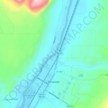
Name: Tonasket topographic map, elevation, terrain.
Average elevation: 342 m
Minimum elevation: 267 m
Maximum elevation: 627 m
Other topographic maps
Click on a map to view its topography, its elevation and its terrain.