
Engreux topographic map
Interactive map
Click on the map to display elevation.
About this map
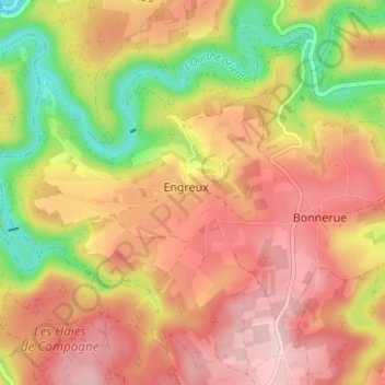
Name: Engreux topographic map, elevation, terrain.
Location: Engreux, Bastenaken, Luxemburg, Wallonië, 6663, België (50.10104 5.68301 50.14104 5.72301)
Average elevation: 388 m
Minimum elevation: 265 m
Maximum elevation: 475 m