
Le Culot topographic map
Interactive map
Click on the map to display elevation.
About this map
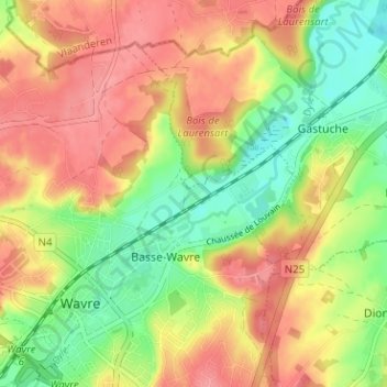
Name: Le Culot topographic map, elevation, terrain.
Location: Le Culot, Waver, Nijvel, Waals-Brabant, Wallonië, 1300, België (50.70836 4.60890 50.74836 4.64890)
Average elevation: 71 m
Minimum elevation: 28 m
Maximum elevation: 108 m