
Ouled Ayad topographic map
Interactive map
Click on the map to display elevation.
About this map
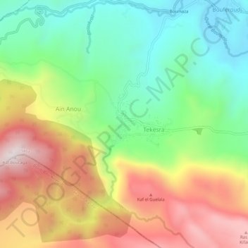
Name: Ouled Ayad topographic map, elevation, terrain.
Average elevation: 963 m
Minimum elevation: 610 m
Maximum elevation: 1,433 m
Other topographic maps
Click on a map to view its topography, its elevation and its terrain.
Boumaza
Algérie > Sétif > Daïra Hammam Guergour > Hammam Guergour > Bouferoudj
Boumaza, Bouferoudj, Hammam Guergour, Daïra Hammam Guergour, Sétif, Algérie
Average elevation: 731 m