
Outer Banks topographic map
Interactive map
Click on the map to display elevation.
About this map
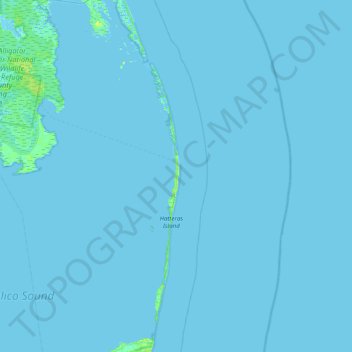
Name: Outer Banks topographic map, elevation, terrain.
Average elevation: 0 m
Minimum elevation: -2 m
Maximum elevation: 8 m
Other topographic maps
Click on a map to view its topography, its elevation and its terrain.
Blowing Rock
United States of America > North Carolina > Blowing Rock
The climate in the area can be described as warm-summer humid continental (Dfb), or highland subtropical climate (Cfb) depending on the isotherm used. This results in an unusual climate compared to the rest of North Carolina; the town's elevation of 3,500 to 3,600 feet (1,100 to 1,100 m) above sea level…
Average elevation: 1,032 m
Watauga County
United States of America > North Carolina
As with most of North Carolina's High Country, the climate of Watauga County is that of a Humid continental climate characterized by considerably cooler and more drastic weather than other parts of the state. Dramatic and unexpected changes in the weather are not uncommon in the county, particularly when it…
Average elevation: 984 m