
Edmonton topographic map
Interactive map
Click on the map to display elevation.
About this map
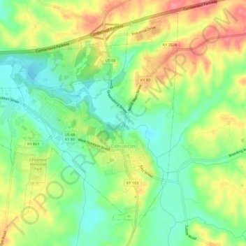
Name: Edmonton topographic map, elevation, terrain.
Location: Edmonton, Metcalfe County, Kentucky, 42129, United States (36.96446 -85.65517 37.00398 -85.59988)
Average elevation: 254 m
Minimum elevation: 215 m
Maximum elevation: 303 m
Other topographic maps
Click on a map to view its topography, its elevation and its terrain.
Summer Shade
United States > Kentucky > Metcalfe County
Summer Shade, Metcalfe County, Kentucky, 42166, United States
Average elevation: 280 m