
Hammam Sillal topographic map
Interactive map
Click on the map to display elevation.
About this map
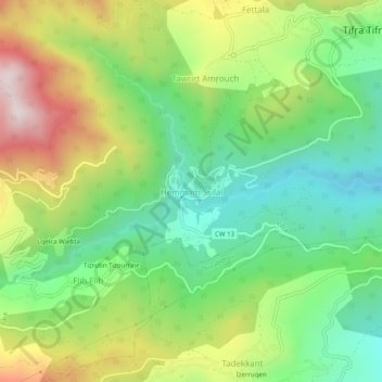
Name: Hammam Sillal topographic map, elevation, terrain.
Location: Hammam Sillal, Tifra, Daïra Sidi-Aïch, Béjaïa, 06412, Algérie (36.62942 4.65479 36.66942 4.69479)
Average elevation: 474 m
Minimum elevation: 178 m
Maximum elevation: 949 m