
Choungui topographic map
Interactive map
Click on the map to display elevation.
About this map
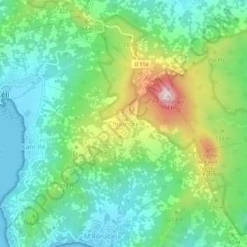
Name: Choungui topographic map, elevation, terrain.
Location: Choungui, Kani-Kéli, Mayotte, 97625, France (-12.98128 45.10692 -12.94128 45.14692)
Average elevation: 155 m
Minimum elevation: 0 m
Maximum elevation: 504 m