
Puy Clavel topographic map
Interactive map
Click on the map to display elevation.
About this map
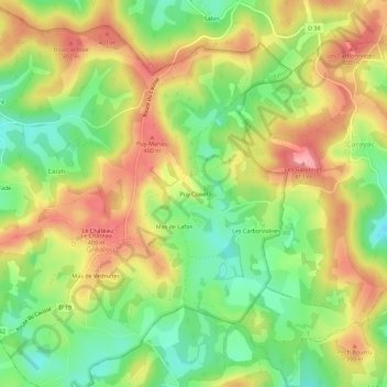
Name: Puy Clavel topographic map, elevation, terrain.
Average elevation: 352 m
Minimum elevation: 294 m
Maximum elevation: 412 m
Other topographic maps
Click on a map to view its topography, its elevation and its terrain.
Le Château
France > Occitanie > Lot > Gréalou
Le Château, Gréalou, Figeac, Lot, Occitanie, France métropolitaine, 46160, France
Average elevation: 347 m
Mas de Vedrunes
France > Occitanie > Lot > Gréalou
Mas de Vedrunes, Gréalou, Figeac, Lot, Occitanie, France métropolitaine, 46160, France
Average elevation: 340 m
Le Château
France > Occitanie > Lot > Gréalou > Le Château
Le Château, Gréalou, Figeac, Lot, Occitanie, France métropolitaine, 46160, France
Average elevation: 343 m