
Green Lake County topographic map
Interactive map
Click on the map to display elevation.
About this map
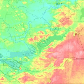
Name: Green Lake County topographic map, elevation, terrain.
Location: Green Lake County, Wisconsin, USA (43.63175 -89.24556 43.98357 -88.88511)
Average elevation: 263 m
Minimum elevation: 228 m
Maximum elevation: 334 m
Other topographic maps
Click on a map to view its topography, its elevation and its terrain.
Scandinavia
USA > Wisconsin > Scandinavia
Scandinavia, Waupaca County, Wisconsin, USA
Average elevation: 293 m
Sand River
Sand River, Town of Bayfield, Bayfield County, Wisconsin, USA
Average elevation: 258 m
Dodgeville
USA > Wisconsin > Dodgeville
Dodgeville, Iowa County, Wisconsin, USA
Average elevation: 370 m
Gays Mills
USA > Wisconsin > Gays Mills
Gays Mills, Crawford County, Wisconsin, USA
Average elevation: 272 m