
Chobe topographic map
Interactive map
Click on the map to display elevation.
About this map
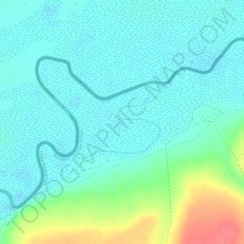
Name: Chobe topographic map, elevation, terrain.
Location: Chobe, Chobe District, Botswana (-17.88345 24.77438 -17.87489 24.78502)
Average elevation: 940 m
Minimum elevation: 921 m
Maximum elevation: 993 m
Other topographic maps
Click on a map to view its topography, its elevation and its terrain.
Chobe National Park
Chobe National Park, Nogatsaa - Savuti, Chobe District, Botswana
Average elevation: 964 m