
Hong Kong Island topographic map
Interactive map
Click on the map to display elevation.
About this map
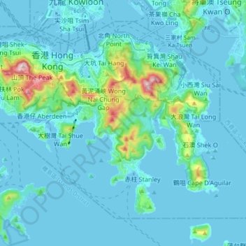
Name: Hong Kong Island topographic map, elevation, terrain.
Average elevation: 53 m
Minimum elevation: -6 m
Maximum elevation: 534 m
Other topographic maps
Click on a map to view its topography, its elevation and its terrain.
North District
North District, New Territories, Hong Kong, China
Average elevation: 115 m