
South District topographic map
Interactive map
Click on the map to display elevation.
About this map
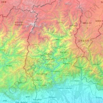
Name: South District topographic map, elevation, terrain.
Location: South District, Namchi District, Sikkim, 737139, India (26.63333 87.71667 28.03333 89.11667)
Average elevation: 2,687 m
Minimum elevation: 73 m
Maximum elevation: 8,402 m
Other topographic maps
Click on a map to view its topography, its elevation and its terrain.
Zemu Glacier
Zemu Glacier, North District, North Sikkim District, Sikkim, India
Average elevation: 5,499 m
North District
North District, North Sikkim District, Sikkim, India
Average elevation: 3,842 m