
Gulf topographic map
Interactive map
Click on the map to display elevation.
About this map
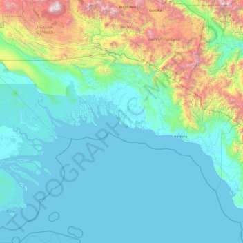
Name: Gulf topographic map, elevation, terrain.
Location: Gulf, Papua Region, Papua New Guinea (-8.77548 142.99411 -6.70544 146.65251)
Average elevation: 495 m
Minimum elevation: -2 m
Maximum elevation: 4,166 m
Other topographic maps
Click on a map to view its topography, its elevation and its terrain.
Gulf of Papua
Gulf of Papua, Kerema District, Gulf, Papua Region, Papua New Guinea
Average elevation: 394 m