
Port Lavaca topographic map
Interactive map
Click on the map to display elevation.
About this map
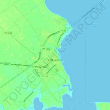
Name: Port Lavaca topographic map, elevation, terrain.
Location: Port Lavaca, Calhoun County, Texas, United States (28.57754 -96.66239 28.65958 -96.60012)
Average elevation: 4 m
Minimum elevation: -1 m
Maximum elevation: 11 m
Other topographic maps
Click on a map to view its topography, its elevation and its terrain.
Port O'Connor
United States > Texas > Calhoun County
Port O'Connor, Calhoun County, Texas, 77982, United States
Average elevation: 3 m