
Gwalior topographic map
Interactive map
Click on the map to display elevation.
About this map
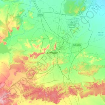
Name: Gwalior topographic map, elevation, terrain.
Average elevation: 235 m
Minimum elevation: 165 m
Maximum elevation: 382 m
Gwalior is located at 26°13′N 78°11′E / 26.22°N 78.18°E / 26.22; 78.18. in northern Madhya Pradesh 300 km (186 miles) from Delhi. It has an average elevation of 197 metres (646 feet). Most part of it comes under the Bundelkhand area.