
Chester Springs topographic map
Interactive map
Click on the map to display elevation.
About this map
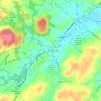
Name: Chester Springs topographic map, elevation, terrain.
Average elevation: 112 m
Minimum elevation: 66 m
Maximum elevation: 188 m
Other topographic maps
Click on a map to view its topography, its elevation and its terrain.
West Pikeland
United States > Pennsylvania > Chester County > West Pikeland Township
West Pikeland, West Pikeland Township, Chester County, Pennsylvania, 19425, United States
Average elevation: 122 m