
Metsimotlhabe topographic map
Interactive map
Click on the map to display elevation.
About this map
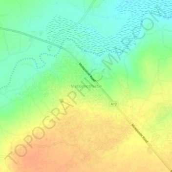
Name: Metsimotlhabe topographic map, elevation, terrain.
Location: Metsimotlhabe, Kweneng District, Botswana (-24.57371 25.78834 -24.53371 25.82834)
Average elevation: 993 m
Minimum elevation: 974 m
Maximum elevation: 1,012 m