
Mansfield topographic map
Interactive map
Click on the map to display elevation.
About this map
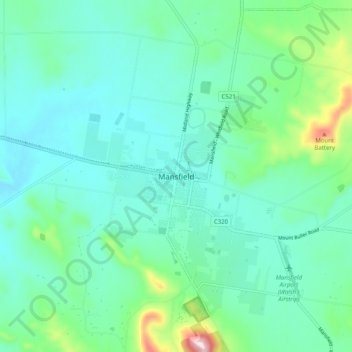
Name: Mansfield topographic map, elevation, terrain.
Average elevation: 357 m
Minimum elevation: 291 m
Maximum elevation: 627 m
Other topographic maps
Click on a map to view its topography, its elevation and its terrain.
Lake Eildon
Australia > Victoria > Mansfield
Lake Eildon, Maroondah Highway, Mansfield, Mt Buller Mt Stirling, Victoria, 3722, Australia
Average elevation: 376 m