
Geraldton topographic map
Interactive map
Click on the map to display elevation.
About this map
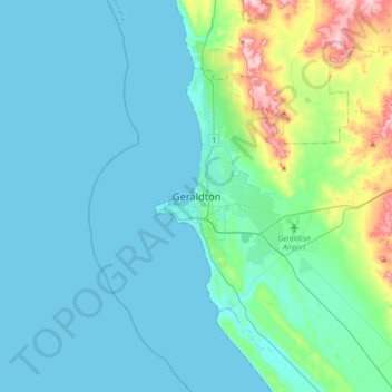
Name: Geraldton topographic map, elevation, terrain.
Location: Geraldton, Western Australia, WA 6530, Australia (-28.93035 114.45472 -28.61035 114.77472)
Average elevation: 33 m
Minimum elevation: -1 m
Maximum elevation: 223 m